设计与自然景观融合,是众多景观设计师孜孜不倦的追求。
来自宾夕法尼亚大学的景观建筑硕士Prakul,面对具有悠久历史的Lehigh山谷板岩带和富有怀旧感的居民,设计出自然与实用功能结合的物质文化公园,为生态和居民交上满意的答卷。小编为大家解锁公园的设计理念和景观设计师的设计心得。
作品

Parks of Material Culture
物质文化公园
Prakul Pottapl
University of Pennsylvania
宾夕法尼亚大学
Master of Landscape Architecture
景观建筑硕士
Project
项目
The studio project focuses on the slate belt region in the Lehigh valley in Pennsylvania whose history, memory and identity are closely tied to material and landscape. Permeability and impermeability of these materials and landscapes have shaped this region over time. Rocks are quarried for their impermeability and soils cultivated for their appropriate permeability, the cultural landscape is constantly shaped and reshaped by the notion of permeability in many aspects.
该工作室项目的重点是宾夕法尼亚州Lehigh山谷的板岩带,其历史、回忆和特性与材料、景观密切相关。这些材料和景观的渗透性和不渗透性随着时间的推移塑造了这个区域。岩石因其不渗透性而开采,土壤因其适当的渗透性而被耕种,文化景观在许多方面不断被渗透的概念所塑造和重塑。

The proposal is series of parks that celebrate the specific material culture and provide shared spaces for these towns, facilitating in amplifying their presence in the Lehigh Valley by connecting them together.
该方案是赞美此特殊的物质文化而建的系列公园,并为这些城镇提供共享空间,通过将它们连接在一起,有助于扩大它们在利哈伊山谷的存在。

A sense of nostalgia exists among the people of the slate belt who were a part of the vibrant slate mining industrial past. The quarries were landscapes they intimately knew.
居住在板岩带的人们,作为曾经是生机勃勃的板岩矿业的一部分,与生俱来一种怀旧感。采石场是他们非常熟悉的风景。

In order to channel this nostalgia and intimacy, the drawings are inspired by old topographical maps and sections. The views try to take a painterly approach combining analog photo collage, water coloring and using portions of photographs of oil paintings.
为了传达这种怀旧和亲密感,图纸的灵感来自于旧的地形图和剖面图。设计视图尝试采用绘画方法,结合模拟照片拼贴,水彩及使用部分油画照片。

Interview
访谈
How important was the notion of representation for the project?
项目的代表性概念有多重要?
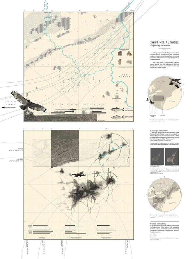
The project began with the making of maps of the Lehigh Valley region while being aware of the biases involved in the making of maps. The way in which these maps were visualized added to this bias, setting a mood and tone for the future of the project. Representation was key to building the project narrative, the story I wanted to tell, which in turn influenced the scale of the interventions and the imagination of the spaces.
该项目首先制作Lehigh Valley地区的地图,同时意识到制作地图时存在偏见。这些地图视觉化地增加了这种偏见,为项目的未来动态奠定了情绪基调。表现感是构建项目叙事的关键,我想讲的故事反过来影响了干预的规模和空间的想象力。
What is your take on the map? To what extent do you agree with the term ‘the map is not the territory’?
你对地图有什么看法?你在多大程度上同意“地图不是领土”这个词?
In my mind, a map is a drawing that constructs relationships between places, objects and people. Over the centuries many mapping conventions have been developed and defined to make sharing and understanding maps much easier, but the potential of maps lies in its ability to reimagine and redefine relationships. When Alfred Korzybski first used the phrase ‘the map is not the territory’ he was bringing to light the fact that a map was just a representation of reality but not reality itself, and this is something I completely agree with. However, for architects and landscape architects to propose designs, the map is a very important drawing – “a constructed reality/territory” into which interventions could be drawn and visualized.
在我看来,地图是一种构建地点,物体和人之间关系的绘图。几个世纪以来,已经开发和定义了许多绘图惯例,以便更容易地共享和理解地图,但地图的潜力在于其重新构想和重新定义关系的能力。当Alfred Korzybski第一次使用“地图不是领土”这个短语时,他揭露了一个事实,即地图只是现实的表象,而不是现实本身,这是我完全赞同的。然而,对于建筑师和景观设计师提出设计方案时,地图是一个非常重要的图纸 - 可以将“构建的现实/领土”的干预描绘及可视化。

How did you record the site both in terms of physical landscape and attitude of the inhabitants?
你是如何根据自然景观和居民的态度记录网站的?
The topographical information for the two quarries were extracted from a high resolution digital elevation model. Photography was the most useful tool in terms of recording the site in terms of key views and material qualities. Material samples of different forms of slate from the sites were collected to experiment with various compositions. There were many meetings and interviews with the people of the towns where they told stories about what these quarries used to be like when they were operational and how different living in these towns was. Their stories painted nostalgic pictures and this definitely influenced the spaces and the visuals for the project.
两个采石场的地形信息是从高分辨率数字高程模型中提取的。就关键视图和材料质量而言,摄影是记录网站最有用的工具。收集来自这些部位的不同形式的板岩的材料样品以试验各种组合物。他们与城镇居民进行了多次会面和采访,讲述了这些采石场在运营时的情况,以及这些城镇的生活方式。他们的故事描绘了怀旧的画面,这无疑影响了项目的空间和视觉效果。

What is your take on threshold between analogue and digital? When confronting the act of drawing and representing medium do you find yourself working most comfortable with and why?
您对模拟和数字之间的门槛有何看法?当面对绘画和代表媒介的行为时,你发现自己最舒服,为什么?
Over the years I have realized that I enjoy operating in the threshold. Moving from one medium to the other keeps me energized and excited. After hours of staring at the screen, making analogue collages and drafting perspectives feels almost therapeutic. That being said, during the initial stages of drawing and representing I am most comfortable with pencil on paper paired with a bit of photoshop.
多年来,我意识到我喜欢在门槛上运作。从一种媒介转移到另一种媒介让我充满活力和兴奋。经过几个小时的盯着屏幕,制作模拟拼贴和绘制透视图的感觉几乎是治疗性的。话虽如此,在绘画和展示的初始阶段,我最舒服的是纸上的铅笔与photoshop共同协作。

What is your most precious tool?你最宝贵的工具是什么?
That will definitely have to be a wooden graphite pencil. Sketching an idea or drafting a section, if I have a pencil or can find one I will survive.
那肯定是木制的石墨铅笔。如果我有一支铅笔或能找到一支,勾勒出一个想法或起草一部分,我就能活下去。

If you could articulate all of the project in one drawing – what would this be?
如果你能在一张图纸中清楚地表达所有项目 - 那会是什么?
This is something I haven’t really figured out! It is tricky because the project starts with a regional map and ends with a view of a pool in the quarry. I think it could be a large map showing the two quarries in relation to each other with the surrounding towns. The collages could get strategically nested in the grid of the map. I think this drawing would have actually benefitted the project.
这是我还没想到的事情!这很棘手,因为项目以区域地图开始,最后是采石场中的游泳池视图。我想这可能是一张大型地图,显示了与周围城镇相关的两个采石场。拼贴可以战略性地嵌套在地图的网格中。我认为这张图实际上会使该项目受益。

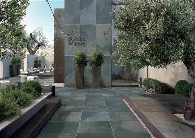
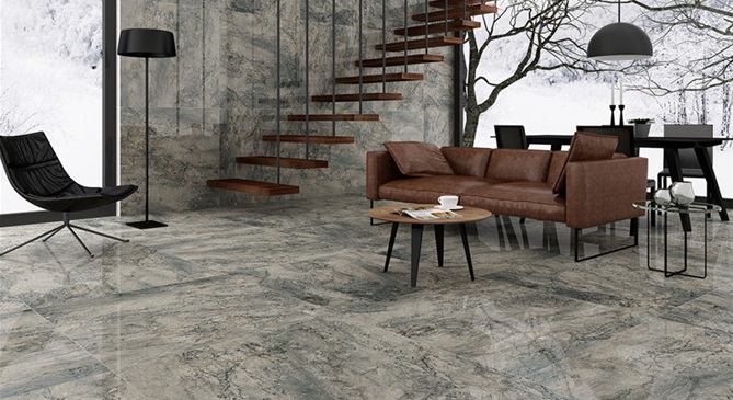
唯格2CM石英砖 | MU系列
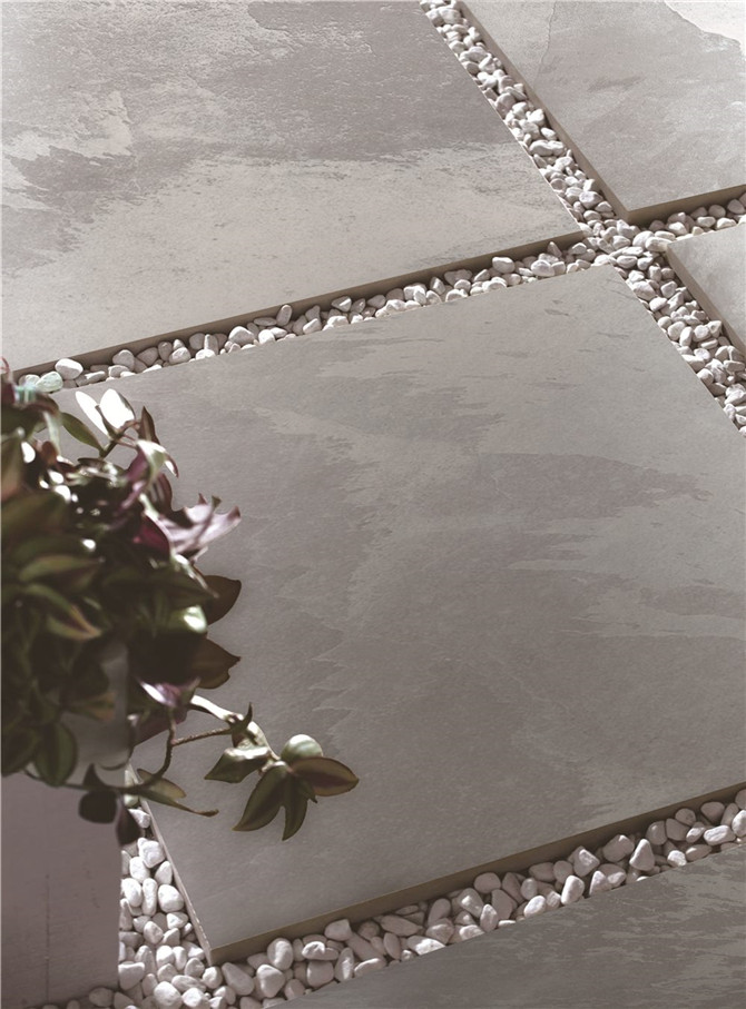
MUSTANG 安第斯板岩
精选世界最长的山系——巍峨延绵的安第斯山脉,将独特的激情与板岩的纹理原始结合在一起,描绘出逐层的变化和自然创造的岩石痕迹,精美地展现石板的颜色。
安第斯板岩系列,纹理如山脉纵横,沟壑明显、视觉印象深刻,正是自然与艺术的结晶。






 相关文章
相关文章


 头条焦点
头条焦点

 精彩导读
精彩导读